


Hurricane Ian became a major Category 3 storm early Tuesday and will continue to strengthen as it approaches Florida, according to forecasters from the National Hurricane Center.
Ian made landfall around 4:30 a.m. ET Tuesday in western Cuba, just southwest of the town of La Coloma in Pinar del Río province, with maximum sustained winds of 125 mph, U.S. officials said .
The hurricane, now in the southeastern Gulf of Mexico, is moving north toward Florida at 10 mph and strengthening, according to the National Hurricane Center’s 5 p.m. update.
The latest on Hurricane Ian
- Hurricane Ian made landfall in western Cuba as a major hurricane early Tuesday, leaving 1 million people without power.
- Ian will likely continue to strengthen as it moves above warm Gulf of Mexico winds reaching 130 mph as it approaches the southwest coast of Florida.
- Tropical storm-force winds are expected Tuesday evening in Florida’s southern peninsula, reaching hurricane force on Wednesday – when the eye of the hurricane is expected to make landfall.
- About 2.5 million residents are under some type of evacuation order in Florida.
- Ian will slow to 3 to 4 mph Thursday and Friday on or near Florida’s west coast, extending the impacts of storm surge, wind and flash flooding.
- The Governor of Georgia has declared a state of emergency…
Ian’s center could become a Category 4 hurricane as it continues to move over the Gulf, NBC News forecasters said.
Ian will continue to intensify today through Wednesday as it approaches the west coast of Florida on Wednesday “like an extremely dangerous major hurricane,” according to the National Hurricane Center.
Models show the storm making landfall somewhere between Tampa Bay and Charlotte Harbor. The system is expected to slow as low as 3-4 mph, prolonging the impacts of heavy rain, strong winds and storm surge.
Follow NBC News’ live coverage of Hurricane Ian
Tornadoes on the Florida Peninsula are also possible over the next three days.
Storm surge may also affect Florida’s east coast where a warning has been issued from Marineland to St. Marys River along the Georgia coast, according to the hurricane center.
Florida Governor Ron DeSantis has declared a statewide emergency, saying Ian could bring several feet of storm surge. Charlotte Harbor can see 12 feet of storm surge, and in the Tampa Bay area, 7 feet are expected, forecasters say.
“What we have here is really historic storm surge and potential for flooding,” he said at a news conference on Tuesday morning. “This storm surge can be deadly.”
DeSantis encouraged residents to heed evacuation orders in place from Pinellas County to the Fort Myers area. About 2.5 million residents are under some type of evacuation orders, he said.
Parts of the state can also be without power for three days to a week, according to Florida Division of Emergency Management Director Kevin Guthrie, who spoke at the press conference.
Georgia and South Carolina could also see an impact from Ian.
Georgia Governor Brian Kemp declared a state of emergency for all counties on Tuesday, which will take effect Thursday at 7 a.m. and expire Friday at midnight.
As the storm headed toward Florida, oil companies evacuated workers from deepwater rigs in the Gulf of Mexico and airports in Tampa, Orlando and Pinellas County in Florida announced they would close Tuesday and Wednesday. American Airlines has announced travel waivers for people traveling to or from 20 airports in Florida and the Caribbean.
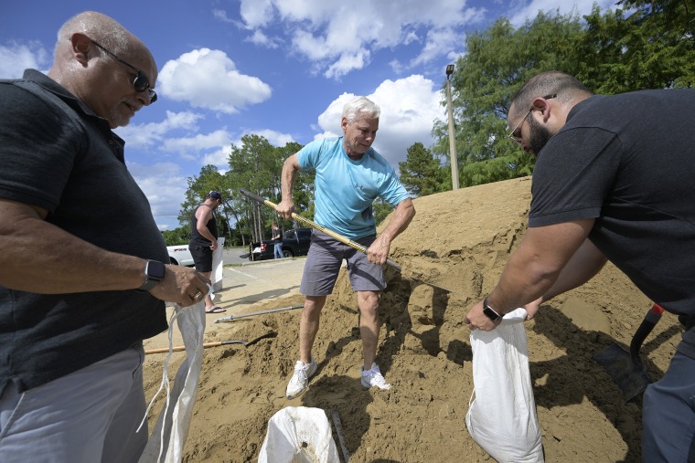
Florida Gulf Coast residents stocked up on food and prepared with sandbags and plywood for their windows. Hundreds of thousands of people were under evacuation orders.
“This storm is trending down, which means it could potentially stay on us for 47 hours,” said Cathie Perkins, director of Tampa’s NBC WFLA affiliate Pinellas County Emergency Management.
“It’s a lot of rain, and it’s not going to be able to drain quickly,” she said.


